


|
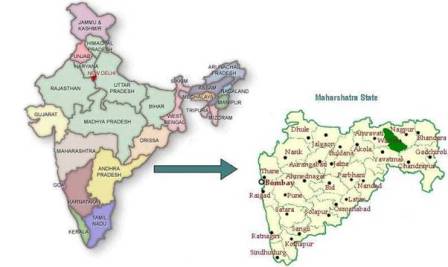
Map of India (with Maharashtra State) (Green Highlighted section is Wardha District) |
 |
Interactive Google Map
View Larger Map
India Map with Maharashtra State
Anji Facts
| Nearest Railway Station | Wardha, Nagpur |
Nearest Airport |
Nagpur |
Nearest big city |
Nagpur (80 Kms) |
Distance from Mumbai |
Around 700 Kms |
Distance from Chennai |
Around 1200 kms |
STD Code |
07152 |